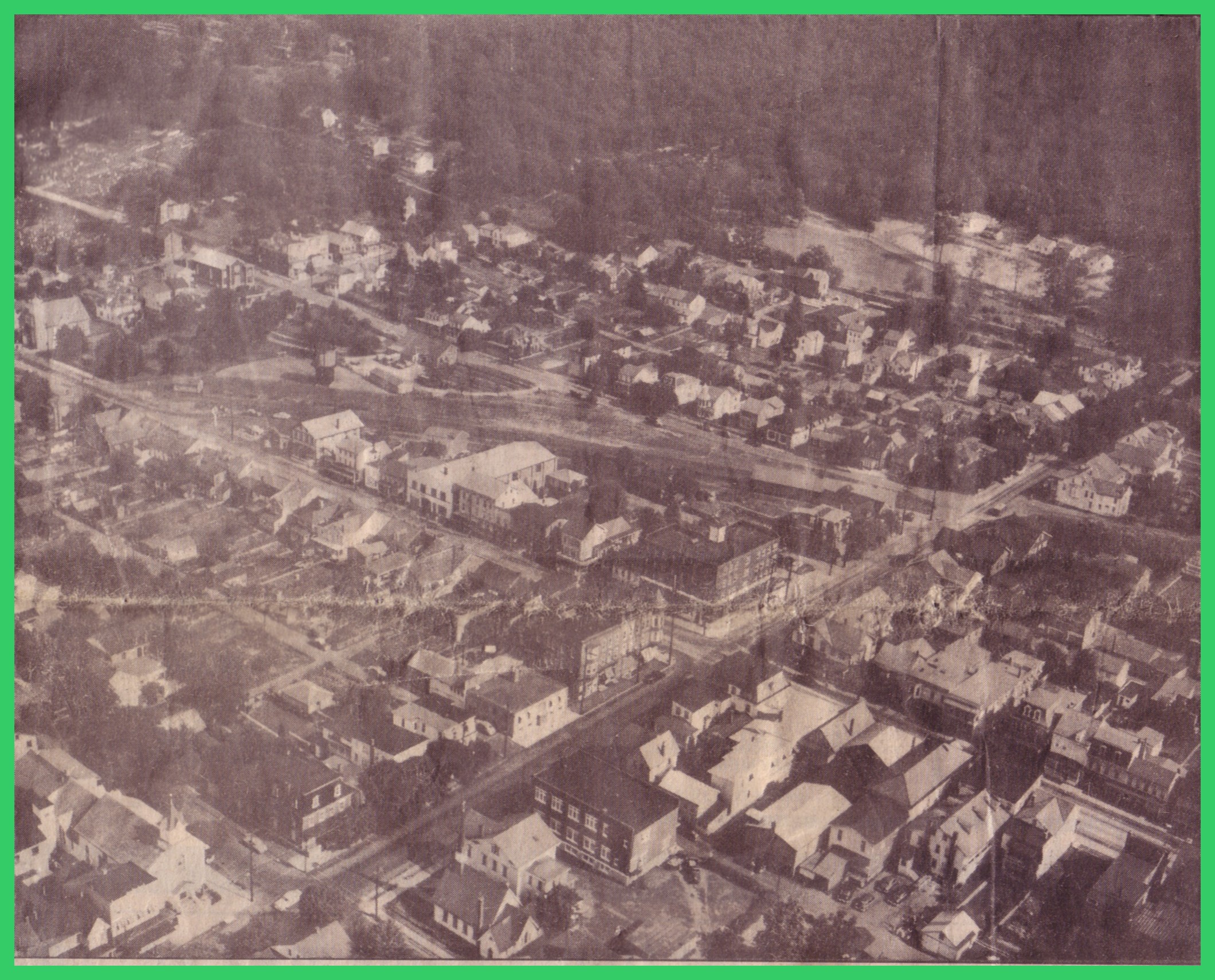
A newspaper photo of a 1959 aerial view of Lykens, Dauphin County, Pennsylvania, looking south-southeast.
The main square of the town can be seen just below center, with Market Street running from lower left to center right, and Main Street (Route 209) running from center left to lower right. The larger building where the streets cross at the square is the Lykens Hotel. Just above the Lykens Hotel in the photo is the rail yard area, which appears to be mostly dismantled, although the old water tower can still be seen at the eastern end of what was the rail yard.
An aerial view of Lykens, Dauphin County, Pennsylvania, looking south-southeast, taken about 1959. _________________________________ Corrections and additional information should be added as comments to this post. This historical photo appeared in the Citizen Standard (Valley View, Schuylkill County, Pennsylvania), 28 September 1990, as a part of a feature, “Know Your…
An undated photo post card view of Main Street, Lykens, Dauphin County, Pennsylvania, looking west. Hensel's Clothing Store is at right on the northeast corner of the main square. From the picture, it does not appear that the brick Hotel Lykens has yet been built on the southeast corner of…
An aerial photograph of Lykens, Dauphin County, Pennsylvania, showing destruction caused by the Wiconisco Creek in the vicinity of North Street and Division Street, from the Great Flood of 1972. ___________________________________ From “Collector’s Limited Edition” of Lykens and Williams Valley Flood of 1972, published by the Lykens Standard, Lykens, Dauphin…