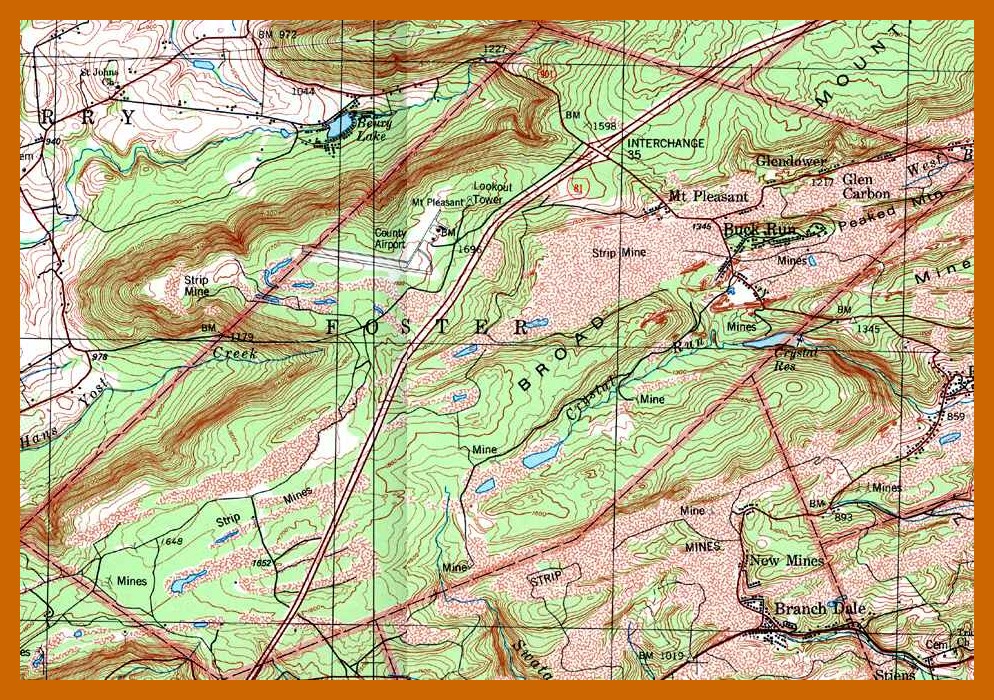
An undated topographical map of Foster Township, Schuylkill County, Pennsylvania, produced by the United States Coast and Geodetic Survey. The communities of Glen Carbon, Buck Run, Mt. Pleasant, and Glendower are part of Foster Township.
The topographical maps show roads, railroads, airports, rivers and streams, houses of worship, cemeteries, land features, elevations, radio towers, schools, etc. The maps also give GPS coordinates for any features on the map.
For availability of maps from different time periods, go to USGS Store and search for “Lykens, Pennsylvania” in the map locator box. Then click on the blue “View Products” box connected to the blue “pin” A full list of available maps for the vicinity of Lykens will appear in a list at the right. For each available map, a “pdf” is available. Click on the “view pdf” box and the map will appear in your default “pdf” program. However, the maps cannot be downloaded, but most can be enlarged up to 400% without losing detail. There is also a green box for each map, which indicates the price of a print which can be ordered directly from the site.
______________________________
Corrections and additional information should be added as comments to this post.
